
Rupin Pass Trek
Rupin Pass Trek
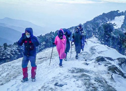
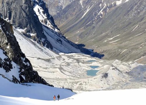
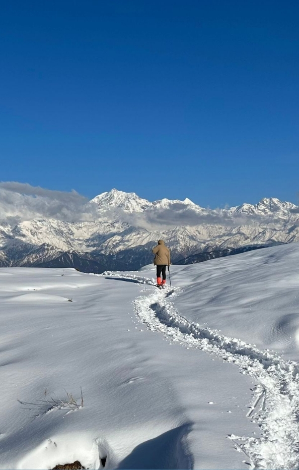
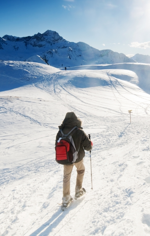
The Rupin Pass Trek is one of the most adventurous and scenic high-altitude treks in the Indian Himalayas, reaching an elevation of about 4,650 meters (15,250 ft). Starting from Dhaula in Uttarakhand and ending at Sangla in Himachal Pradesh, it offers a rare cross-state trekking experience that feels like a journey through multiple worlds in a single trail. The trek follows the Rupin River, leading trekkers through dense pine and oak forests, hanging villages, glacial valleys, meadows, and rocky terrains, while also crossing snow bridges and cascading waterfalls, including the famous two-stage waterfall near Jhaka, also known as the “hanging village.”
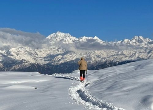
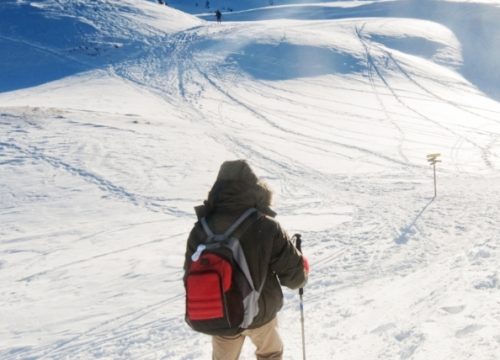
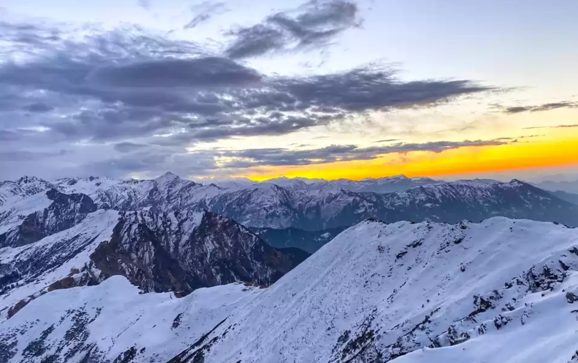
Every day on the Rupin Pass Trek surprises adventurers with ever-changing landscapes – from lush green valleys and blooming rhododendrons in summer to golden meadows and crisp skies in autumn. The final ascent to the pass is thrilling and challenging, involving steep climbs over snow and rock, but the reward is spectacular: panoramic views of the Kinnaur Kailash Range and other Himalayan peaks.
How to Reach Rupin Pass Trek
Rupin Pass is one of the most popular high-altitude treks in India, located in the Himalayas of Uttarakhand and Himachal Pradesh. The trek usually starts from Dhaula (Uttarakhand) and ends at Sangla (Himachal Pradesh), crossing the scenic Rupin Valley and the high mountain pass at 15,250 ft (4,650 m).
Here’s a step-by-step guide on how to reach the starting point of Rupin Pass Trek (Dhaula):
1. Reach Dehradun (Base City)
By Air:
The nearest airport is Jolly Grant Airport, Dehradun (25 km from city center). Flights connect from Delhi, Mumbai, Bangalore, etc.By Train:
The nearest railway station is Dehradun Railway Station, well connected with Delhi, Varanasi, Kolkata, etc.By Road:
Regular buses (Volvo, deluxe, govt.) operate from Delhi (ISBT Kashmiri Gate) to Dehradun (~250 km / 6–7 hrs).
2. Dehradun to Dhaula (Trek Starting Point)
Distance: ~210 km
Time: 8–10 hrs by road
Route: Dehradun → Purola → Netwar → Dhaula
Transport:
You can hire a taxi/jeep from Dehradun (₹6,000–7,000 approx. for a vehicle).
Shared jeeps are available up to Netwar, from where you may get local transport to Dhaula.
Some trek organizers arrange direct transport from Dehradun to Dhaula for participants.
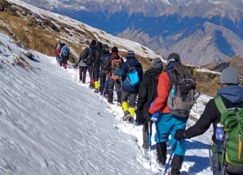
3. The Trek Itself
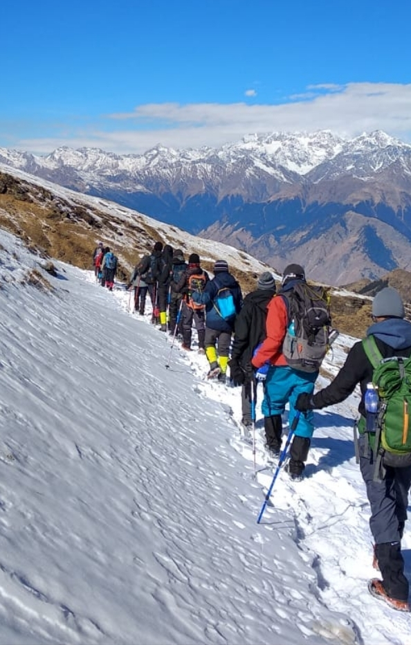
Duration: 7–8 days
Difficulty: Moderate to Difficult (requires good fitness)
Route (common itinerary):
Dhaula → Sewa
Sewa → Jiskun
Jiskun → Udaknal
Udaknal → Dhanderas Thach
Dhanderas Thach → Upper Waterfall Camp
Upper Waterfall → Rupin Pass → Ronti Gad
Ronti Gad → Sangla (end point)
4. Return from Sangla (Himachal Pradesh)
From Sangla, take a local/shared jeep to Shimla (230 km / 8–10 hrs).
From Shimla:
By Road: Buses and taxis to Delhi/Chandigarh.
By Train: Narrow gauge (Shimla–Kalka) → connect to Kalka–Delhi train.
By Air: Nearest airport is Jubbarhatti Airport, Shimla (though flights are limited). Chandigarh Airport is more reliable.
✅ Pro Tip: Best time to do Rupin Pass Trek is May–June (summer) and September–October (autumn). Avoid monsoon (July–August) due to landslides and slippery trails.
Near Places To Rupin Pass Trek
Near Dhaula (Starting Point in Uttarakhand)
1. Purola
A charming little town on the way to Dhaula.
Surrounded by deodar and pine forests, it is often called the “Gateway to Har-ki-Dun Valley.”
Great place to shop for basic trek supplies or to enjoy local Garhwali cuisine.
2. Mori (Tons Valley)
Located on the banks of the Tons River, known for adventure activities like river rafting.
Offers serene campsites by the riverside and opportunities for fishing.
Mori is surrounded by lush green forests of pine and deodar, making it a quiet pre-trek getaway.
3. Netwar
A small village famous for the ancient Pokhu Devta Temple, built in traditional wooden Himachali-Garhwali style.
Also the entrance to the Govind Pashu Vihar National Park, which protects species like the snow leopard, Himalayan black bear, and musk deer.
4. Har-ki-Dun Valley
A nearby trek that starts from Sankri (close to Dhaula).
Known as the “Valley of Gods”, it offers vast meadows, ancient villages, and views of Swargarohini peaks.
Perfect for trekkers who want to combine Rupin Pass with another moderate trek.
🌄 Along the Trek Route
Even while on the Rupin Pass trail, you pass through fascinating villages and landscapes:
Sewa & Jiskun Villages → Known for unique wooden temples and traditional Himachali/Garhwali architecture.
Dhanderas Thach → A breathtaking meadow with colorful wildflowers and streams, perfect for photography.
Upper Waterfall Camp → One of the most iconic camping sites in the Himalayas, set right next to Rupin waterfall.
🏔️ Near Sangla (Ending Point in Himachal Pradesh)
1. Sangla Valley (Baspa Valley)
Known for its orchards, traditional wooden houses, and snow-clad peaks.
The Baspa River adds charm, making it one of Himachal’s most scenic valleys.
Don’t miss Kamru Fort, a centuries-old wooden fortress overlooking the valley.
2. Chitkul
The last inhabited village of India near the Indo-Tibetan border (20 km from Sangla).
Famous for its wooden houses, potato farms, and the Baspa River flowing alongside.
A must-visit for its raw beauty and cultural feel.
3. Kalpa (Kinnaur)
About 40 km from Sangla, known for mesmerizing views of Kinner Kailash Peak.
Beautiful apple orchards and peaceful monasteries make it an ideal stop for relaxation.
4. Rakcham
A picturesque village between Sangla and Chitkul.
Often called the “Switzerland of India” due to its alpine scenery.
Great for short hikes and riverside camping.
5. Recong Peo
The district headquarters of Kinnaur.
A bustling town with local markets and monasteries, offering glimpses into Kinnauri culture.
Serves as a base for onward journeys to Spiti Valley.
🛕 Spiritual and Cultural Spots
Pokhu Devta Temple (Netwar) → An ancient shrine deeply revered by locals.
Kamakhya Devi Temple (Sangla) → Known for intricate wood carvings and cultural significance.
Bering Nag Temple (Sangla) → Famous for the Fulaich Fair, a vibrant local celebration.
🌸 Other Treks Nearby
Borasu Pass Trek → Extends from Har-ki-Dun Valley to Chitkul, more challenging than Rupin.
Buran Ghati Trek → Another crossover trek starting near Janglik (close to Rohru, Himachal), ending at Barua in Kinnaur.
Kinner Kailash Parikrama → A sacred and challenging trek circling Mount Kinner Kailash.
Other Tours
- Adi Kailash
- Aulli
- Bali Pass Trek
- Bararsar Lake
- Borasu Pass Trek
- Brahmatal Trek
- Chopta
- Dayara Bugyal Trek
- Goechala Trek
- Har Ki Dun Trek
- Haridwar
- Jungle Safari
- kausani
- Kedarkantha Trek
- Kuri Pass
- Maldaru Tal Trek
- Manali
- Munsiyari
- Nagtibba Trek
- Nainital
- Neem Karoli Baba Ashram Kainchi Dham
- Panch Kedar
- Ruinsara Lake
- Rupin Pass Trek
- Sandakphu Trek
- Valley Of Flowers Trek
Quick Links
Itinerary
Altitude: ~2,700 m (8,850 ft)
Activities:
Relax in Sangla after your trek.
Visit Kamru Fort (800-year-old fort overlooking the valley).
Explore Bering Nag Temple, a sacred site with rich wooden carvings.
Stroll through apple orchards and riverside meadows by the Baspa River.
Walk through Sangla’s bustling local market for handicrafts and woolens.
Stay: Riverside homestay or guesthouse in Sangla.
Food to Try: Kinnauri Rajma, local trout fish, and Himachali siddu.
Distance: ~25 km (1 hr drive)
Altitude: ~3,450 m (11,320 ft) at Chitkul
Activities:
Drive through the scenic Rakcham village, often called the “Switzerland of Himachal.”
Continue to Chitkul, the last inhabited village of India near the Indo-Tibetan border.
Walk along the Baspa River, enjoy mountain vistas, and explore traditional wooden houses.
Visit Mathi Devi Temple, said to be more than 500 years old.
Relax with short hikes around the meadows, or just unwind in the quiet surroundings.
Stay: Guesthouse in Chitkul with views of snowy peaks.
Tip: Nights can be very cold here — carry extra layers.
Distance: ~60 km (3–4 hrs)
Altitude: ~2,960 m (9,711 ft)
Activities:
Drive along winding mountain roads to Kalpa, a serene Kinnauri village.
Visit Reckong Peo, the district headquarters, known for monasteries and local bazaars.
Reach Kalpa, famous for stunning views of the Kinner Kailash range.
Visit Suicide Point, a cliff offering breathtaking views of the valley.
Explore Roghi Village, known for its old-style wooden houses and traditional Himachali lifestyle.
Stay: Homestay or boutique hotel in Kalpa overlooking the Kinner Kailash peaks.
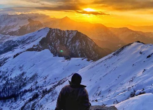
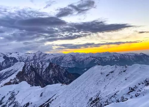
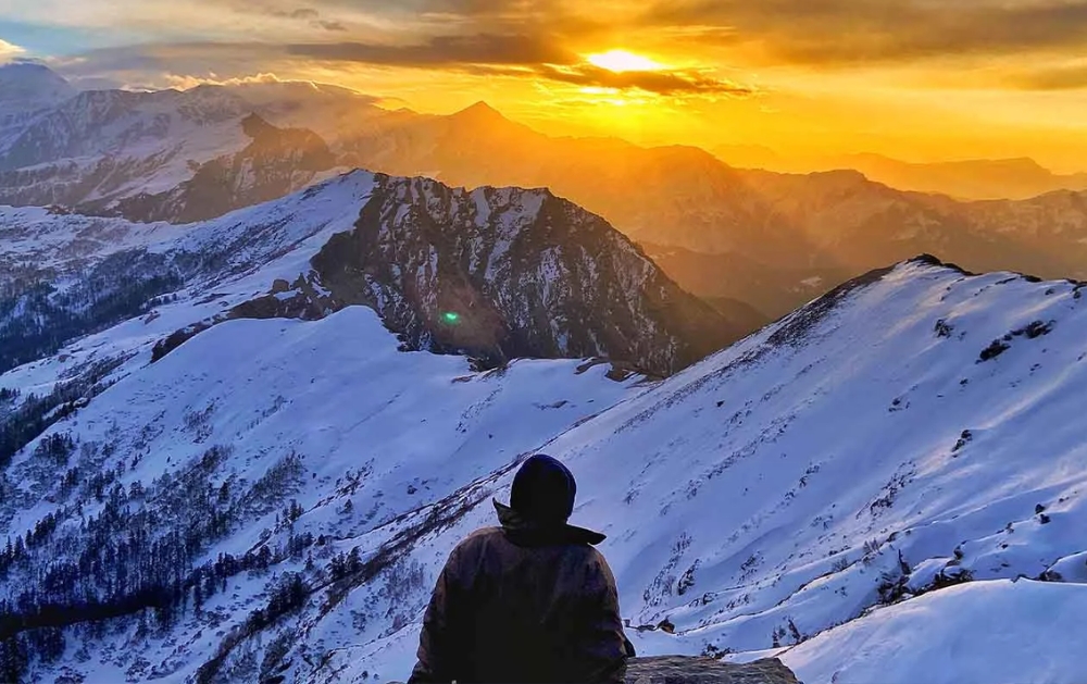
Evening Highlight: Watch the sunset over Kinner Kailash—the golden glow is unforgettable.
Distance: ~110 km (4–5 hrs)
Altitude: ~3,625 m (11,893 ft)
Activities:
Drive to Nako, one of the highest villages in Himachal.
Visit Nako Lake, a beautiful high-altitude lake surrounded by poplar and willow trees.
Explore Nako Monastery, dating back to the 11th century and associated with the great Buddhist master Atisha.
Walk through Nako’s narrow lanes and admire traditional stone and mud houses.
Stay: Local guesthouse in Nako with mountain views.
Tip: Even in summer, nights here are very cold; keep warm clothes handy.
Option 1: Drive towards Shimla
Distance: ~310 km (10–11 hrs)
Stay overnight in Shimla, the colonial hill station, and relax with leisurely walks on Mall Road.
Option 2: Drive towards Chandigarh
Distance: ~335 km (11–12 hrs)
Reach the plains and spend the night in Chandigarh before taking a train/flight back.
Tabo Monastery (Spiti Valley) → If time permits, extend your journey from Nako to Tabo, one of the oldest Buddhist monasteries in the Himalayas.
Sarahan → On the way back from Sangla, you can detour to this village famous for the Bhimakali Temple and Himalayan views.
- Best Time: May–June and September–October (post-monsoon) for clear skies.
- Transport: Local buses, shared jeeps, or private taxis are available. Roads are narrow and winding, so plan buffer time.
- Culture: Respect local customs, especially around temples and monasteries. Dress modestly.
- Connectivity: Mobile network is weak beyond Sangla; carry offline maps.
Book a Tour
Frequently Asked Questions for Rupin Pass Trek
Rupin Pass lies at the border of Uttarakhand and Himachal Pradesh. The trek starts from Dhaula (Uttarakhand) and ends at Sangla (Himachal Pradesh).
The highest point of the trek is 4,650 m (15,250 ft).
It is rated Moderate to Difficult. It involves long walking hours, steep ascents/descents, and crossing snowfields. Prior trekking experience is highly recommended.
You should be able to:
Jog 5 km in under 35–40 minutes.
Carry a backpack of 8–10 kg comfortably.
Have good stamina and leg strength.
Cardio, strength training, and stair climbing are excellent preparation.
Summer: May–June → Snow patches, blooming meadows, waterfalls.
Autumn: September–October → Clear skies, golden valleys, less snow.
Avoid July–August (monsoon) due to heavy rains and landslides.